Over eight millennia on seven hills — from Thracian Eumolpias and Roman Trimontium, through Ottoman Filibe and the National Revival, to the Unification and the present day.
The oldest part of the city — here the Thracian settlement of Eumolpias was founded, later the acropolis of Philippopolis. Walls and towers survive from the 4th c. BC (cyclopean masonry), a 6th-c. Byzantine postern tunnel (under Justinian) and a large cistern. The site reopened to visitors in 2025 after restoration.
Probably the best-known ancient monument in Bulgaria, built in the 90s of the 1st century AD under Emperor Domitian. Set in the saddle between two of the three hills, it seated about 7,000 on two tiers of 14 rows each. Studied and restored between 1968 and 1984, it is among the best-preserved Roman theatres in the world and still hosts the Opera Open and other festivals.
One of the largest structures of Roman Philippopolis, built in the 2nd century under Emperor Hadrian and modelled on the stadium at Delphi. Around 240 metres long, it could hold up to 30,000 spectators for athletic games staged by the provincial assembly of Thrace — games the city's mint celebrated on its coins. Today only the northern curve, with 14 rows of seats, is exposed beneath Dzhumaya Square; the rest lies under the modern city.
One of the oldest Ottoman mosques in the Balkans, dated to 1363–1364 (Sultan Murad I). It has nine domes and a single minaret and stands beside the Ancient Stadium.
An architectural-historical reserve on Nebet, Dzhambaz and Taksim Tepe, famous for its 19th-c. Revival houses — such as the Kuyumdzhioglu House (1847, now the Ethnographic Museum). It has been on UNESCO's tentative list since 2004.
not applicable for a natural hill or terrain feature
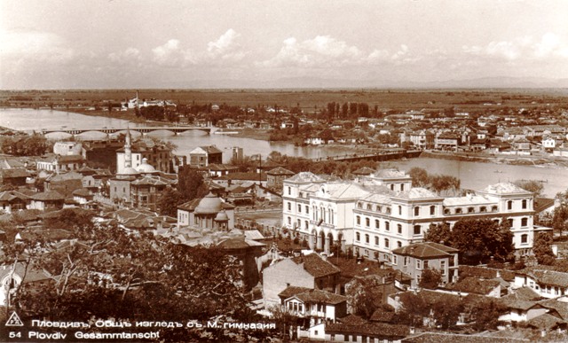
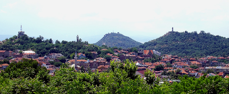
Plovdiv is built on syenite hills and is known as "the city of the seven hills". Six survive today — Markovo Tepe was quarried away during the 20th century.
The city of Plovdiv is the main spatial record for events connected with the whole city rather than a specific building, street or archaeological site.
The civic heart of Roman Philippopolis: a public square begun under Emperor Vespasian in the 1st century and completed in the 2nd, covering about 11 hectares. Ringed by shops, the city council's Odeon and other public buildings, it was the focal point of the ancient street grid, near today's central post office.
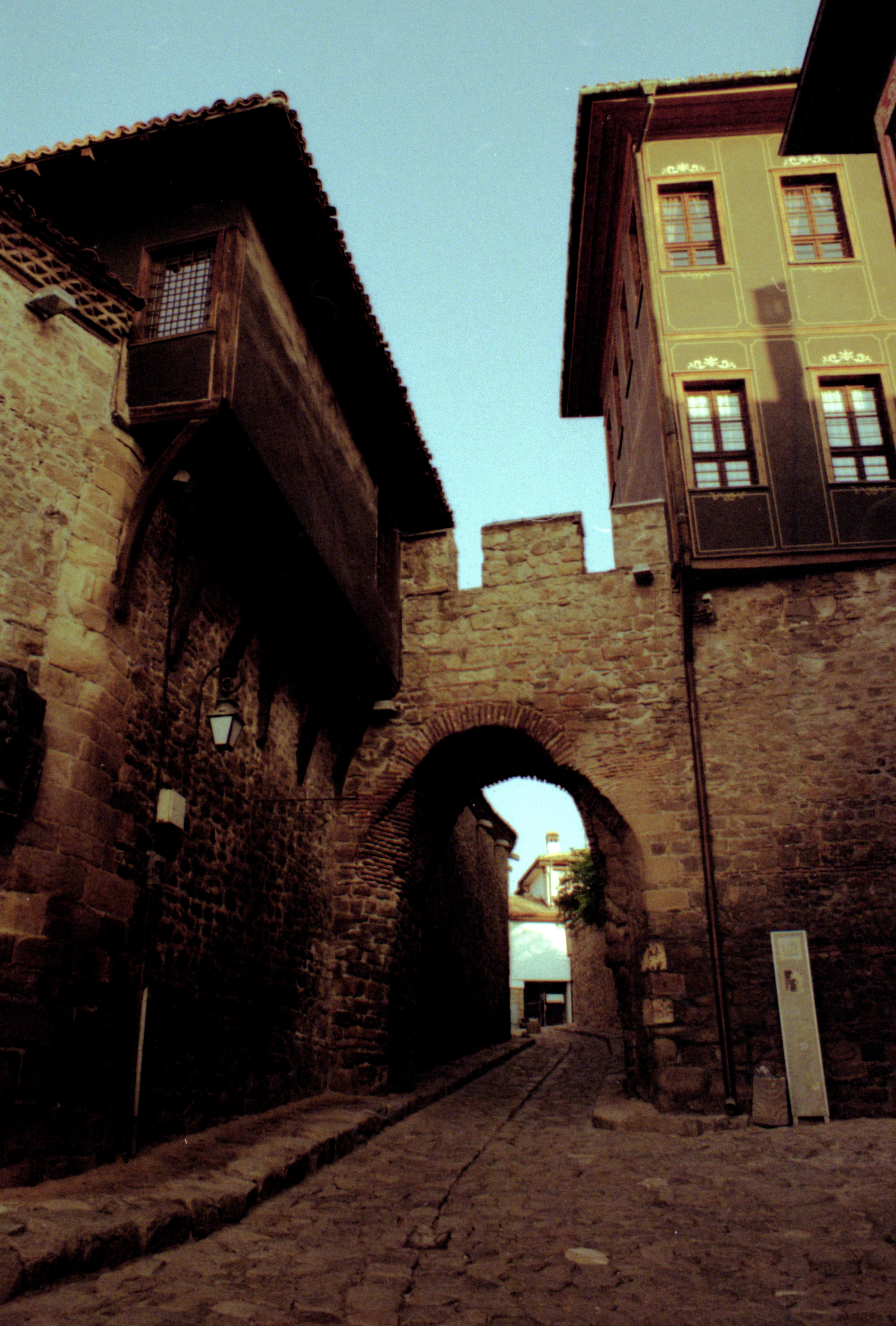
Hisar Kapia is one of the most recognizable gates in the Old Town. It marks the historic fortification line and links the ancient and medieval core with the later National Revival urban fabric.
The Cathedral of St Louis is a Catholic church in central Plovdiv and an important part of the city's 19th-century religious and architectural history.
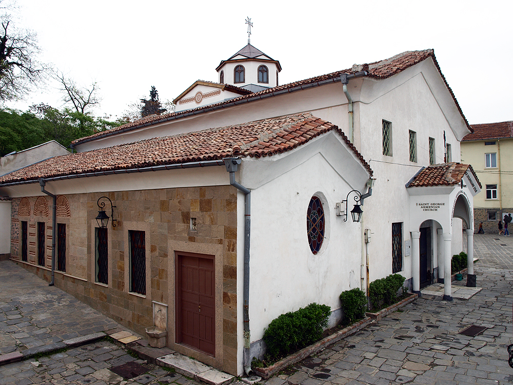
The Church of the Holy Mother of God is an Orthodox church in the Old Town and an important site in Plovdiv's religious, National Revival and civic history.
The sliders compare an archive image with a modern open-licensed photo of the same place or the nearest verifiable urban context.
Then · 20th c. Now
Balkan cinema in Plovdiv — then/now
Comparison between the archive image “Balkan cinema in Plovdiv” and a modern open-licensed image of Kino Balkan.
Then (20th c.): Unknown author · Public domain Now: Gitanes232 · CC BY-SA 4.0
Then · 1928 Now
Chirpan earthquake damage near St Josif — then/now
Comparison between the archive image “Chirpan earthquake damage near St Josif” and a modern open-licensed image of Hospital St Josif, Plovdiv.
Then (1928): Unknown author · Public domain Now: Unknown auther, Owner - Пловдивъ, Католишката / Павликянската махала, до към 1960-та (@katolishka.mahala.plovdiv) · Public domain
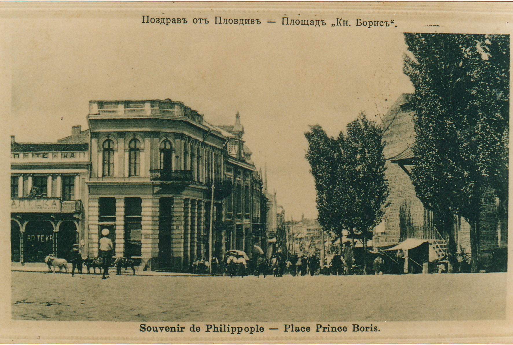
Then · early 20th c. Now
Dzhumaya Square on an old postcard — then/now
Comparison between the archive image “Dzhumaya Square on an old postcard” and a modern open-licensed image of Dzhumaya square.
Then (early 20th c.): VladislavNedelev · Public domain Now: Ivanowitsch · CC BY-SA 3.0
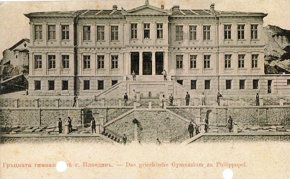
Then · early 20th c. Now
Greek High School in Plovdiv — then/now
Comparison between the archive image “Greek High School in Plovdiv” and a modern open-licensed image of Geo Milev Primary School.
Then (early 20th c.): Unknown author · Public domain Now: Isip2 westboro · Public domain
Then · 1928 Now
Ivan Vazov National Library after the earthquake — then/now
Comparison between the archive image “Ivan Vazov National Library after the earthquake” and a modern open-licensed image of Ivan Vazov National Library.
Then (1928): Unknown author · Public domain Now: Спасимир · CC BY-SA 3.0
Then · February 1972 Now
Lamartine House restoration archive, 1972 — then/now
Comparison between the archive image “Lamartine House restoration archive, 1972” and a modern open-licensed image of Lamartine House.
Then (February 1972): PeterDix = Peter Dikidjiev, architect and town planner, NYCity = · CC BY-SA 3.0 Now: Juan Antonio F. Segal, Wikimedia Commons · CC BY 2.0
Then · 1930s Now
Old Bridge and Gerdzhika Bridge in the 1930s — then/now
Comparison between the archive image “Old Bridge and Gerdzhika Bridge in the 1930s” and a modern open-licensed image of Gerdzhika Bridge.
Then (1930s): Unknown photographer · Public domain Now: PEYCHO PANAYOTOV · CC BY-SA 3.0
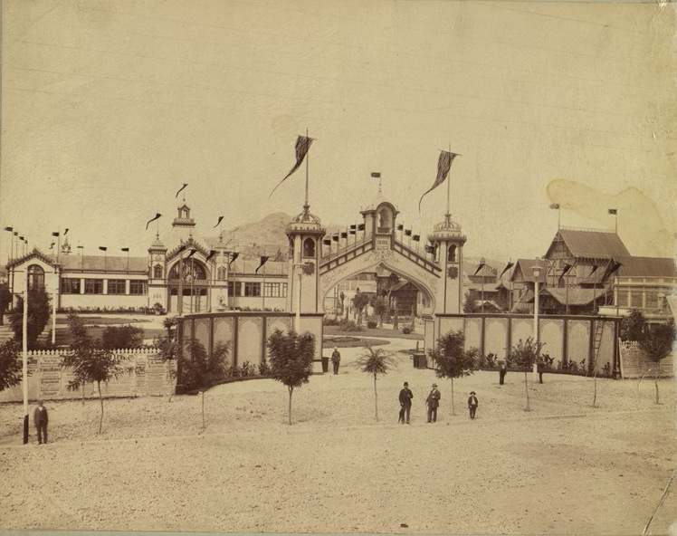
Then · 1939 Now
Opening of the 1939 Plovdiv Fair — then/now
Comparison between the archive image “Opening of the 1939 Plovdiv Fair” and a modern open-licensed image of International Fair Plovdiv.
Then (1939): Unknown author · Public domain Now: Boyan.prodanov · Public domain
People Connections
The network includes every person, while mayoral succession is a separate layer within it.


 Then · 20th c. Now
  Then · 1928 Now
  Then · early 20th c. Now
 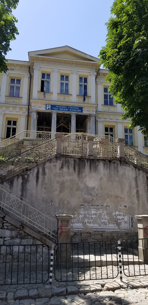 Then · early 20th c. Now
 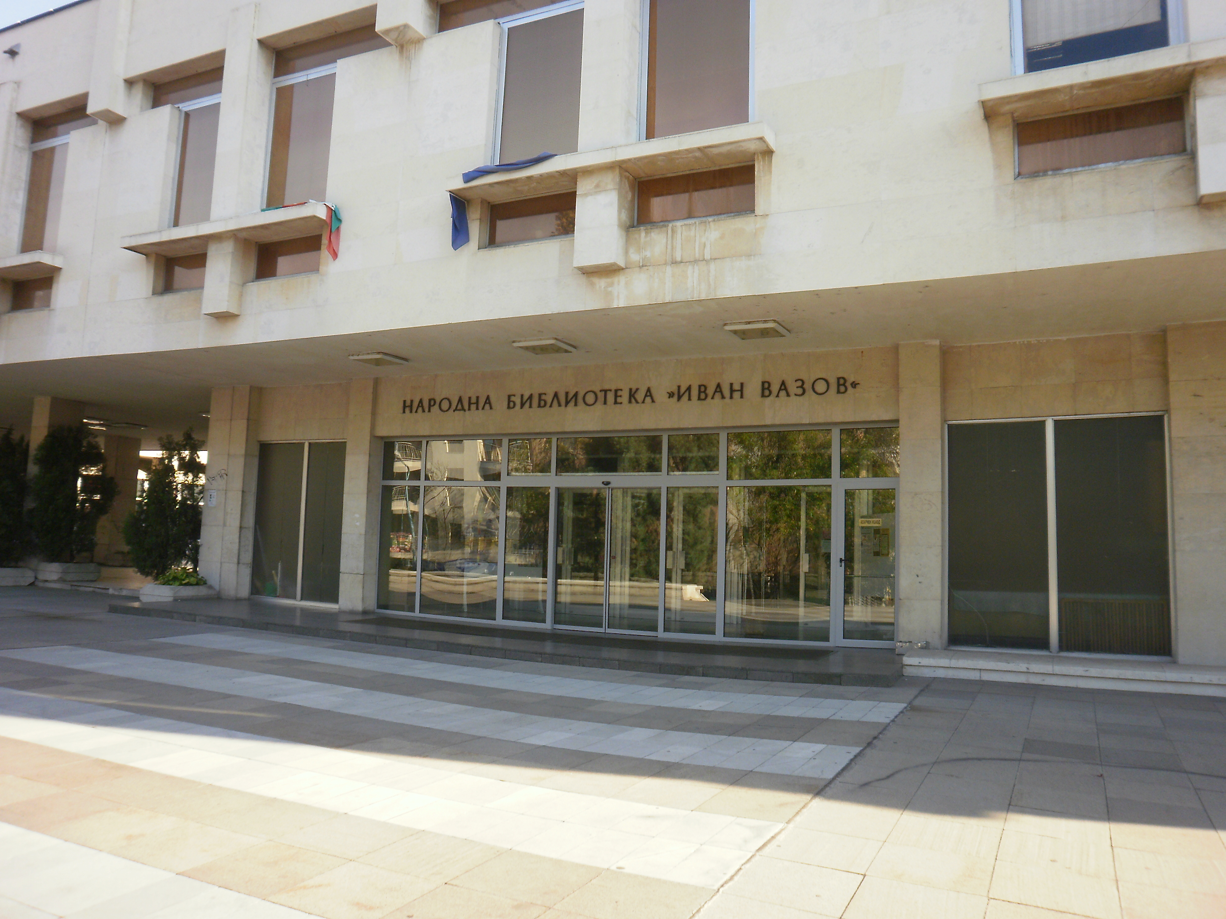 Then · 1928 Now
  Then · February 1972 Now
 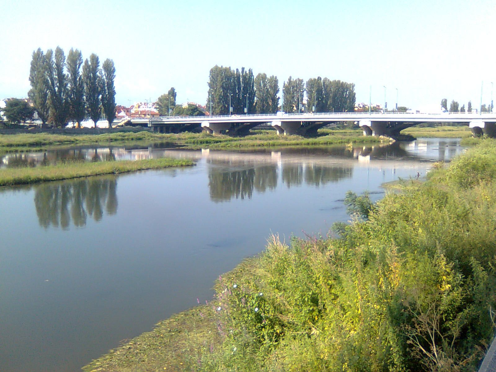 Then · 1930s Now
  Then · 1939 Now