Over eight millennia on seven hills — from Thracian Eumolpias and Roman Trimontium, through Ottoman Filibe and the National Revival, to the Unification and the present day.
Follow the city from its first hilltop settlements to present-day Plovdiv. Each chapter pairs a visual story with concise, verifiable events.
Images show present-day context or archival references—not reconstructions of every era. Archive records remain pending independent editorial review.
Present-day context Avidius · Public domainChapter 016000–2500 BCPrehistorySettlements on the hills as early as the 6th millennium BC.Explore key events3 highlights · 3 events
6000–5000 BC
Early Neolithic settlements
The first prehistoric settlements in the area of present-day Plovdiv appeared in the Neolithic period, more than 8,000 years ago. Yasa Tepe, in today’s Lauta district, is among the best-studied settlement mounds.
Municipal visitor sources place the earliest traces at Nebet Tepe between the Neolithic 6th millennium BC and the 4th millennium BC. Its layers show a settlement sequence spanning millennia, rather than one uncontested founding date.
Through the Bronze Age the hilltop settlement endured and burials appeared around it. Necropolises near Plovdiv have been dated to the 2nd–3rd millennium BC, marking the long transition toward the later Thracian town.
Present-day context VladislavNedelev · CC BY-SA 3.0Chapter 02600–72 BCThracian eraThracian Eumolpias and Philip II of Macedon's Philippopolis.Explore key events6 highlights · 8 events
6th to early 5th century BC
Bessi and Odrysians in the Plovdiv plain
In the 6th and early 5th centuries BC, the Bessi’s political centre lay in the western part of the Plovdiv plain, while the eastern part was inhabited by the Odrysians. With the rise of the Odrysian kingdom in the mid-5th century BC, it came to dominate the area and absorbed the Bessi union.
The municipality’s historical overview describes the fortified Thracian settlement on the Three Hills as Eumolpia or Eumolpeida. With the rise of the Odrysian kingdom in the 5th century BC, the settlement and its surroundings entered its political orbit.
In 342 BC Philip II of Macedon, or his troops, captured the city. The municipal historical overview links that conquest to the name Philippopolis, while the visitor history describes the fortified settlement as a base for further Macedonian expansion.
c. 270s BC
Destroyed by the Celts
During the Celtic settlement of Eastern Europe the city was destroyed, most likely in the 270s BC, before life on the hills recovered once more.
In 183 BC Philip V of Macedon captured the city, but the Thracians re-conquered it shortly afterwards — one of several times the hill town changed hands in this period.
In 72 BC the Roman general Marcus Lucullus seized the city, but it was soon restored to Thracian control — a prelude to its final incorporation into the Roman Empire in 46 AD.
Present-day context Edal Anton Lefterov · CC BY-SA 3.0Chapter 0346–441Roman periodTrimontium — a brilliant Roman city with a theatre and stadium.Explore key events6 highlights · 7 events
46 AD
Trimontium joins the Roman Empire
Under Emperor Claudius the city was incorporated into the Roman Empire and became the capital of the province of Thrace. The Romans called it Trimontium — "the three hills".
Begun under Emperor Vespasian in the 1st century and finished in the 2nd, the forum of Trimontium covered about 11 hectares. Ringed by shops and public buildings, it was the focal point of the ancient city's streets.
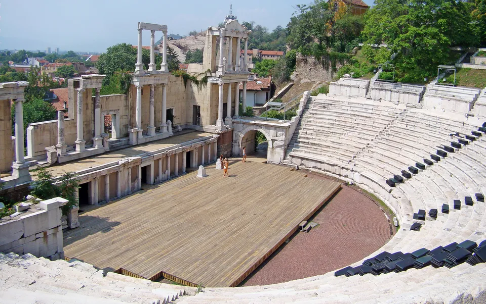
A deciphered inscription dates the construction of the Ancient Theatre to the 90s of the 1st century AD. The municipality’s archaeological overview gives it about 6,000 seats; the site remains an active contemporary cultural venue.
Present-day context Michal Valach, Wikimedia Commons · CC BY-SA 4.0Chapter 04681–1323Middle AgesCenturies of control alternating between Bulgaria and Byzantium.Explore key events6 highlights · 7 events
681 AD
A Byzantine border fortress
The Slavs had settled across the area by the mid-6th century. After the founding of the Bulgarian state in 681, Philippopolis became an important border fortress of the Byzantine Empire.
812
Khan Krum takes the city
Khan Krum captured Philippopolis from Byzantium — the start of a long series of changes of control between Bulgaria and Byzantium.
834
Into the Bulgarian Empire
Khan Malamir incorporated the city into the Bulgarian state, though control would change hands many times over the following centuries.
1204 AD
The Latin Empire and the Duchy of Philippopolis
In 1204 the Latin Empire took Philippopolis, which became the capital of the Duchy of Philippopolis. Over the following decades the city changed hands repeatedly between the Latins, Bulgaria and Byzantium.
Present-day context Ivelin Vraykov · CC BY-SA 3.0Chapter 051364–1564Ottoman periodFive centuries as Filibe — a crossroads of the Balkans.Explore key events5 highlights · 6 events
1363–1364
Ottoman conquest
The municipality’s visitor record dates the Ottoman conquest of the city to 1363–1364. It began centuries of Ottoman rule.
1371
The Battle of Maritsa
By some accounts Plovdiv passed firmly under Ottoman control only after the Battle of Maritsa in 1371, when the townspeople and the Bulgarian army left without resistance and refugees settled in Stanimaka (today's Asenovgrad).
During the Ottoman Interregnum of 1410, Musa Çelebi seized the city, killing and displacing some of its inhabitants.
1364–1443
Centre of Rumelia
From 1364 Filibe was the centre of the Rumelia Eyalet, until in 1443 the capital of Rumelia moved to Sofia. The city remained an important administrative seat in the centuries that followed.
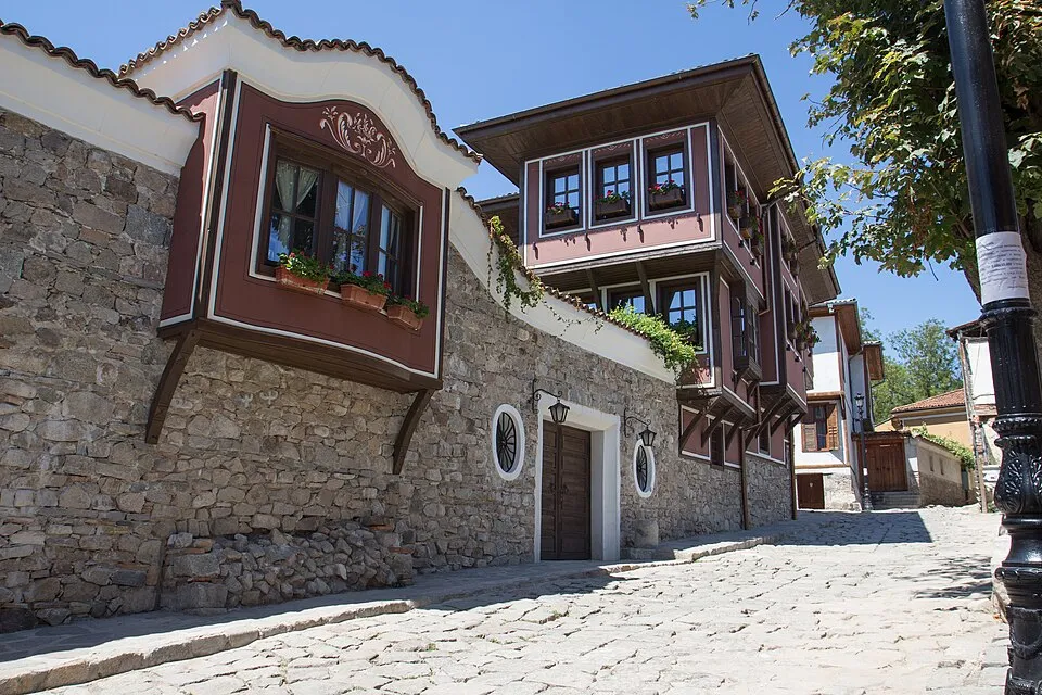
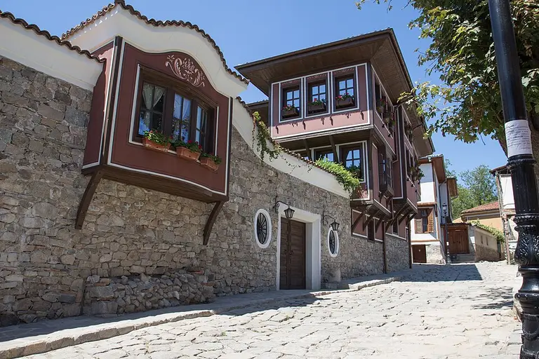
Through this period Filibe was one of the largest economic centres in the Balkans, alongside Istanbul, Edirne, Thessaloniki and Sofia. Wealthier citizens built fine houses, many still preserved today in the Old Plovdiv architectural reserve.
Present-day context Faces&&Places · CC BY 2.0Chapter 061780–1877National RevivalThe Bulgarian educational and church awakening.Explore key events6 highlights · 18 events
1836
The first Bulgarian school
The first Bulgarian school in the city was opened — part of the educational awakening of the National Revival.
1850
Secular education — the St Cyril and Methodius school
In 1850 modern secular education began in the city with the opening of the St Cyril and Methodius school.
1858
Liturgy in Bulgarian
For the first time since the 14th century, the Christmas liturgy was served in Bulgarian — a milestone of the church-national struggle.
11 May 1858
The first Cyril and Methodius celebration
On 11 May 1858 the day of Saints Cyril and Methodius was celebrated for the first time. It later became a national holiday, still marked today (on 24 May after the switch to the Gregorian calendar).
1868
The first grammar school
In 1868 the school grew into the first Bulgarian grammar school. Many future intellectuals, politicians and spiritual leaders of the nation passed through it.
1870
The Bulgarian Church is restored
The re-establishment of the Bulgarian Church (the Exarchate) in 1870 was a mark of national consciousness. Filibe was a centre of the struggle for church independence, with leaders such as Nayden Gerov and Joakim Gruev.
Archive reference · January 1878 Unknown author · Public domainChapter 071878–1885Liberation & UnificationLiberation, the capital of Eastern Rumelia and the Unification.Explore key events5 highlights · 18 events
16 January 1878
Liberation
On the night of 15–16 January 1878, Captain Aleksandr Burago’s detachment entered the city; by the early morning of 16 January Plovdiv was liberated, and General Iosif Gurko arrived with his staff at midday.
By the Treaty of San Stefano (3 March 1878) Plovdiv — then the largest and most vibrant Bulgarian city — was chosen as the capital of the restored country and the seat of the Temporary Russian Government, before the Congress of Berlin redrew the map.
In spring 1885 Zahari Stoyanov founded the Secret Bulgarian Central Revolutionary Committee in Plovdiv. On the night of 5–6 September rebels led by Danail Nikolaev took the city and deposed Governor-General Gavril Krastevich; a provisional government under Georgi Stranski proclaimed the union. 6 September is still marked as the Day of Plovdiv.
A bloodless coup in Plovdiv united Eastern Rumelia with the Principality of Bulgaria. 6 September is celebrated as Unification Day and the Day of Plovdiv.
PLOVDIV 2019 Plovdiv Municipality · CC BY-SA 4.0Chapter 081887–2023Modern eraThe fair city and a European Capital of Culture.Explore key events7 highlights · 298 events
15 August 1892
The first international fair
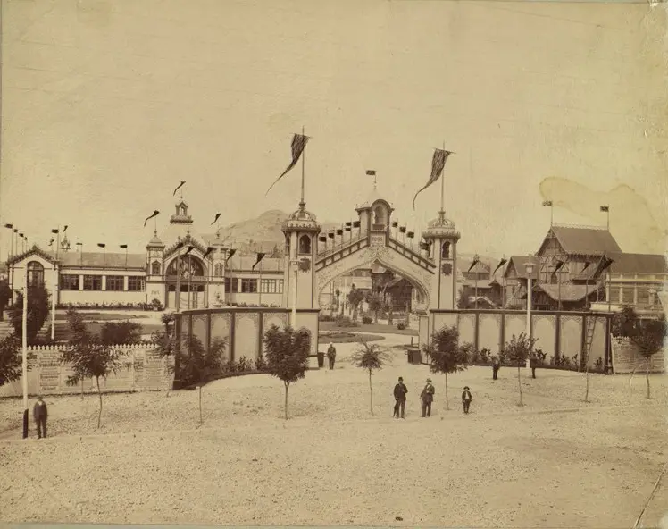
Plovdiv hosted the First Bulgarian Fair with international participation — the origin of the International Fair Plovdiv.
The electrification of Plovdiv began in 1927, as German, French and Belgian capital flowed into modern trade, banking and industry. By 1939 the city counted some 16,000 craftsmen and 17,000 factory workers, mainly in food and tobacco.
The first destructive shock in the Chirpan-Plovdiv earthquake sequence struck southern Bulgaria on 14 April 1928; a second strong shock followed on 18 April, with severe damage in Plovdiv and nearby settlements.
On 10 March 1943 Metropolitan Kiril of Plovdiv intervened for the local Jewish community gathered for deportation and became one of the visible figures in preventing the deportation of Jews from Bulgaria's pre-war territory.
On 1 April 1969, a specialised Old Plovdiv administration was created under the city people's council. The study cites an operating programme through 1975 and BGN 600,000 for 1969, while the city's annual budget was about BGN 25M.
In the late 1980s Plovdiv became a cradle of Bulgaria's movement for democratic reform, which by 1989 had gathered enough support to enter government as communist rule ended.
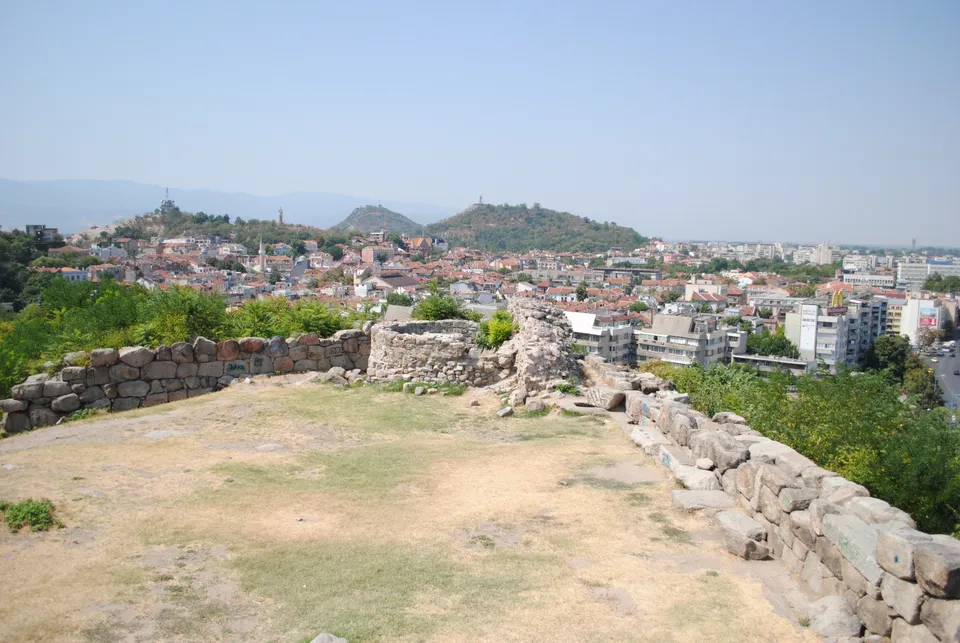
The oldest part of the city — here the Thracian settlement of Eumolpias was founded, later the acropolis of Philippopolis. Walls and towers survive from the 4th c. BC (cyclopean masonry), a 6th-c. Byzantine postern tunnel (under Justinian) and a large cistern. The site reopened to visitors in 2025 after restoration.
Probably the best-known ancient monument in Bulgaria, built in the 90s of the 1st century AD under Emperor Domitian. Set in the saddle between two of the three hills, it seated about 7,000 on two tiers of 14 rows each. Studied and restored between 1968 and 1984, it is among the best-preserved Roman theatres in the world and still hosts the Opera Open and other festivals.
One of the largest structures of Roman Philippopolis, built in the 2nd century under Emperor Hadrian and modelled on the stadium at Delphi. Around 240 metres long, it could hold up to 30,000 spectators for athletic games staged by the provincial assembly of Thrace — games the city's mint celebrated on its coins. Today only the northern curve, with 14 rows of seats, is exposed beneath Dzhumaya Square; the rest lies under the modern city.
One of the oldest Ottoman mosques in the Balkans, dated to 1363–1364 (Sultan Murad I). It has nine domes and a single minaret and stands beside the Ancient Stadium.
An architectural-historical reserve on Nebet, Dzhambaz and Taksim Tepe, famous for its 19th-c. Revival houses — such as the Kuyumdzhioglu House (1847, now the Ethnographic Museum). It has been on UNESCO's tentative list since 2004.
not applicable for a natural hill or terrain feature
Plovdiv is built on syenite hills and is known as "the city of the seven hills". Six survive today — Markovo Tepe was quarried away during the 20th century.
The city of Plovdiv is the main spatial record for events connected with the whole city rather than a specific building, street or archaeological site.
The civic heart of Roman Philippopolis: a public square begun under Emperor Vespasian in the 1st century and completed in the 2nd, covering about 11 hectares. Ringed by shops, the city council's Odeon and other public buildings, it was the focal point of the ancient street grid, near today's central post office.
Hisar Kapia is one of the most recognizable gates in the Old Town. It marks the historic fortification line and links the ancient and medieval core with the later National Revival urban fabric.
The Cathedral of St Louis is a Catholic church in central Plovdiv and an important part of the city's 19th-century religious and architectural history.
The Church of the Holy Mother of God is an Orthodox church in the Old Town and an important site in Plovdiv's religious, National Revival and civic history.
The archive layer links historical maps, photographs and postcards to places in the city. Every item keeps its Wikimedia Commons source and license.
Dimitar Kavra · Public domain
c. 1880
Plovdiv railway station around 1880
Historical photograph of the railway station, linked to the modern Central railway station coordinates.
Place
Plovdiv Central railway station
Georeference
The image is linked to the coordinates of the existing place record: Plovdiv Central railway station.
License
Public domain
Editorial review: This archive record was automatically prepared from Wikimedia Commons and is shown as a provisional reference; independent editorial review and more precise georeferencing are still pending.
Historical view of one of the Three Hills, linked to the modern Dzhambaz Tepe place record.
Place
Dzhambaz hill in Plovdiv
Georeference
The image is linked to the coordinates of the existing place record: Dzhambaz hill in Plovdiv.
License
Public domain
Editorial review: This archive record was automatically prepared from Wikimedia Commons and is shown as a provisional reference; independent editorial review and more precise georeferencing are still pending.
Photograph from the 1892 Plovdiv International Exhibition, from the Bulgarian Archives State Agency collection.
Place
International Fair Plovdiv
Georeference
The image is linked to the coordinates of the existing place record: International Fair Plovdiv.
License
Public domain
Editorial review: This archive record was automatically prepared from Wikimedia Commons and is shown as a provisional reference; independent editorial review and more precise georeferencing are still pending.
Old postcard of Dzhumaya Square, linked to the square and Roman stadium coordinates.
Place
Dzhumaya square
Georeference
The image is linked to the coordinates of the existing place record: Dzhumaya square.
License
Public domain
Editorial review: This archive record was automatically prepared from Wikimedia Commons and is shown as a provisional reference; independent editorial review and more precise georeferencing are still pending.
Panoramic urban archive photograph, georeferenced to central Plovdiv for broad historical orientation.
Place
Plovdiv
Georeference
The image is linked to the coordinates of the existing place record: Plovdiv.
License
Public domain
Editorial review: This archive record was automatically prepared from Wikimedia Commons and is shown as a provisional reference; independent editorial review and more precise georeferencing are still pending.
Bulgarian Archives State Agency postcard showing Tsar Simeon Garden.
Place
Tzar Simeon Garden
Georeference
The image is linked to the coordinates of the existing place record: Tzar Simeon Garden.
License
Public domain
Editorial review: This archive record was automatically prepared from Wikimedia Commons and is shown as a provisional reference; independent editorial review and more precise georeferencing are still pending.
Archive photograph of the library in the context of the 1928 earthquake.
Place
Ivan Vazov National Library
Georeference
The image is linked to the coordinates of the existing place record: Ivan Vazov National Library.
License
Public domain
Editorial review: This archive record was automatically prepared from Wikimedia Commons and is shown as a provisional reference; independent editorial review and more precise georeferencing are still pending.
Old postcard/photo of Gerdzhika, georeferenced to the modern bridge.
Place
Gerdzhika Bridge
Georeference
The image is linked to the coordinates of the existing place record: Gerdzhika Bridge.
License
CC BY 4.0
Editorial review: This archive record was automatically prepared from Wikimedia Commons and is shown as a provisional reference; independent editorial review and more precise georeferencing are still pending.
Archive photograph from the opening of the 1939 Plovdiv Fair, linked to the modern fair complex.
Place
International Fair Plovdiv
Georeference
The image is linked to the coordinates of the existing place record: International Fair Plovdiv.
License
Public domain
Editorial review: This archive record was automatically prepared from Wikimedia Commons and is shown as a provisional reference; independent editorial review and more precise georeferencing are still pending.
Archive photograph of Balkan cinema, linked to the modern building record.
Place
Kino Balkan
Georeference
The image is linked to the coordinates of the existing place record: Kino Balkan.
License
Public domain
Editorial review: This archive record was automatically prepared from Wikimedia Commons and is shown as a provisional reference; independent editorial review and more precise georeferencing are still pending.
Photographic archive material from the uncovering of the Ancient Theatre.
Place
Ancient Theatre
Georeference
The image is linked to the coordinates of the existing place record: Ancient Theatre.
License
CC BY 4.0
Editorial review: This archive record was automatically prepared from Wikimedia Commons and is shown as a provisional reference; independent editorial review and more precise georeferencing are still pending.
Photograph from an archive series for Lamartine House in 1972.
Place
Lamartine House
Georeference
The image is linked to the coordinates of the existing place record: Lamartine House.
License
CC BY-SA 3.0
Editorial review: This archive record was automatically prepared from Wikimedia Commons and is shown as a provisional reference; independent editorial review and more precise georeferencing are still pending.
The sliders compare an archive image with a modern open-licensed photo of the same place or the nearest verifiable urban context.
Then · January 1878 Reference photo
Street in Philippopolis, January 1878 — then/now
Comparison between the archive image “Street in Philippopolis, January 1878” and a modern open-licensed image of The Old Town (Old Plovdiv).
Editorial review: This pairing of a historical image and a reference photo was automatically prepared and is shown as a provisional reference; independent editorial review of the visual match, licence and attribution information, and context is still pending.
Then (January 1878): Unknown author · Public domain Reference photo: Faces&&Places · CC BY 2.0
Then · c. 1880 Reference photo
Plovdiv railway station around 1880 — then/now
Comparison between the archive image “Plovdiv railway station around 1880” and a modern open-licensed image of Plovdiv Central railway station.
Editorial review: This pairing of a historical image and a reference photo was automatically prepared and is shown as a provisional reference; independent editorial review of the visual match, licence and attribution information, and context is still pending.
Then (c. 1880): Dimitar Kavra · Public domain Reference photo: Sharon Hahn Darlin · CC BY 2.0
Then · 1892 Reference photo
Dzhambaz Tepe in 1892 — then/now
Comparison between the archive image “Dzhambaz Tepe in 1892” and a modern open-licensed image of Dzhambaz hill in Plovdiv.
Editorial review: This pairing of a historical image and a reference photo was automatically prepared and is shown as a provisional reference; independent editorial review of the visual match, licence and attribution information, and context is still pending.
Then (1892): Ivan Karastoyanov · Public domain Reference photo: Isip2 westboro · CC BY-SA 4.0
Then · early 20th c. Reference photo
Dzhumaya Square on an old postcard — then/now
Comparison between the archive image “Dzhumaya Square on an old postcard” and a modern open-licensed image of Dzhumaya square.
Editorial review: This pairing of a historical image and a reference photo was automatically prepared and is shown as a provisional reference; independent editorial review of the visual match, licence and attribution information, and context is still pending.
Then (early 20th c.): VladislavNedelev · Public domain Reference photo: Robot8A · CC BY-SA 4.0
Then · early 20th c. Reference photo
Greek High School in Plovdiv — then/now
Comparison between the archive image “Greek High School in Plovdiv” and a modern open-licensed image of Geo Milev Primary School.
Editorial review: This pairing of a historical image and a reference photo was automatically prepared and is shown as a provisional reference; independent editorial review of the visual match, licence and attribution information, and context is still pending.
Then (early 20th c.): Unknown author · Public domain Reference photo: Isip2 westboro · Public domain
Then · early 20th c. Reference photo
Prince’s Garden in Plovdiv — then/now
Comparison between the archive image “Prince’s Garden in Plovdiv” and a modern open-licensed image of Tzar Simeon Garden.
Editorial review: This pairing of a historical image and a reference photo was automatically prepared and is shown as a provisional reference; independent editorial review of the visual match, licence and attribution information, and context is still pending.
Then (early 20th c.): Unknown author · Public domain Reference photo: David Stanley from Nanaimo, Canada · CC BY 2.0
Then · c. 1908 Reference photo
Plovdiv photographed by Ivan Karastoyanov — then/now
Comparison between the archive image “Plovdiv photographed by Ivan Karastoyanov” and a modern open-licensed image of Plovdiv.
Editorial review: This pairing of a historical image and a reference photo was automatically prepared and is shown as a provisional reference; independent editorial review of the visual match, licence and attribution information, and context is still pending.
Then (c. 1908): Ivan Karastoyanov · Public domain Reference photo: Jocelyn Erskine-Kellie from London, UK · CC BY-SA 2.0
Then · 1928 Reference photo
Ivan Vazov National Library after the earthquake — then/now
Comparison between the archive image “Ivan Vazov National Library after the earthquake” and a modern open-licensed image of Ivan Vazov National Library.
Editorial review: This pairing of a historical image and a reference photo was automatically prepared and is shown as a provisional reference; independent editorial review of the visual match, licence and attribution information, and context is still pending.
Then (1928): Unknown author · Public domain Reference photo: Спасимир · CC BY-SA 3.0
365 records
Deep Timeline
Dated records from prehistory to today, including 68 mayoral terms and city-archive events. Every record cites its source.
Try:
Deep Timeline365 records
365 records
Nothing matches this search. Try another word or one of the suggestions.
Explore the city in depthPeople, geography, the city’s growth and open data.
People Connections
The network includes every person, while mayoral succession is a separate layer within it.